Discover the Majestic Santa Elena Canyon
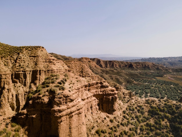
Santa Elena Canyon, located at the far end of Ross Maxwell Scenic Drive, stands as one of the most awe-inspiring landmarks in Big Bend National Park. The canyon’s walls soar dramatically over 1,500 feet on both sides of the Rio Grande, marking the boundary between the United States and Mexico.
Trail Overview
Though it’s a short hike, the Santa Elena Canyon Trail is one of the park’s highlights. It’s occasionally impassable when water levels are high, but when open, it offers a unique journey along the Rio Grande and Terlingua Creek. Here’s your essential guide to navigating this stunning trail.
Santa Elena Canyon Trail Quick Facts
– Distance: 1.3 miles
– Type: Out & Back
– Average Time: 40 minutes
– Difficulty: Moderate
– Dog Friendly: No
The trail immerses you in the canyon’s rugged beauty, featuring towering walls, rushing rivers, and a creek crossing. Walk a half-mile along the Texas side before turning back, always mindful that crossing the Rio Grande into Mexico is illegal.
Trailhead & Parking
Find the trailhead at the end of Santa Elena Canyon Road, accessible from Ross Maxwell Scenic Drive. The parking area is limited but turns over frequently. This spot also serves as a popular launch point for river trips on the Rio Grande. Remember, Big Bend National Park requires an entrance fee.
Best Times to Hike
The best times to hike the Santa Elena Trail are September to November and March to May, when temperatures are most comfortable. Winters (December to February) can be cold with potential precipitation, while summers are extremely hot. Always pack extra water and be prepared for the weather.
The Hiking Experience
Start your adventure from the trailhead sign at the parking lot. The initial stretch is calm and flat, leading to a beach where the Rio Grande meets Terlingua Creek. This spot often features kayaks prepping for river journeys. The trail crosses Terlingua Creek here, which can range from shallow to chest-deep, depending on water levels.
If the main crossing is too deep, an alternative but challenging path exists about 0.1 miles downstream. Note, this detour is not part of the maintained trail and should be used at your own risk.
After crossing the creek, navigate a series of switchbacks that offer fantastic views of the Rio Grande and Terlingua Creek. The remaining hike is relatively flat and easy, with opportunities to climb boulders for even better vistas.
The trail ends at a sheer rock face, but your journey isn’t over until you return the same way, including another creek crossing. Prepare for some attention from onlookers back at the beach.
Tips for a Great Hike
– Stay Hydrated: Carry at least 1 liter of water per person.
– Footwear: Wear sturdy shoes that can handle mud; avoid flip-flops.
– Safety: The cliff area is not maintained and can be risky.
– Clothing: Opt for swimsuits and quick-drying attire to stay comfortable.
For more adventures, explore other incredible destinations:
– Best Things to Do in Big Bend National Park
– Guide to the Congress Bridge Bats, Austin
– Best Day Trips from El Paso
– Top Attractions in Guadalupe Mountains National Park
– White Sands National Park Guide
– Must-See Western US National Parks